Expansion of Federal Land-Use Program Would Benefit Military, Nature, and Communities
Proposed Florida site could limit climate impacts to bases and boost biodiversity and outdoor recreation

In densely populated areas of the U.S., negotiations over land and water conservation almost always come down to competing priorities. In some places, the federal government is surmounting that challenge with a program that offers lasting benefits for nature, communities, economies, and the U.S. military.
The program—a joint project of the U.S. departments of Defense, Agriculture, and the Interior called the Sentinel Landscapes Partnership—plans to designate a suite of new landscapes later this year. A coalition of military installations, federal and state agencies, counties, land trusts, and nongovernmental organizations recently submitted a proposal to establish a new sentinel landscape in a region that is home to multiple military bases, some of the most productive agricultural soils in the state, and more than 100 miles of coastline stretching across three estuary systems. The area also contains habitat for several dozen rare, threatened, or endangered animal and plant species. If approved, the Northeast Florida Sentinel Landscape would be the third such site in the state and would make Florida the only state with three sentinel landscapes.
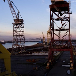
The bases encompassed by the proposed landscape include Naval Air Station Jacksonville, the Navy’s largest installation in the southeast, and the 73,000-acre Camp Blanding Joint Training Center, home to Florida’s Army National Guard and Air National Guard. These and other military installations in the region face challenges because of population growth and encroaching development—which can affect weapons testing and other operations—along with climate-driven threats such as wildfires, flooding, storm surge, and sea-level rise. Add to this increasing urbanization across northeast Florida and the value of a sentinel landscape here is clear: It would help the military focus on its core mission while advancing conservation and sustaining agricultural lands and outdoor recreation-based tourism.
“A Northeast Florida Sentinel Landscape will provide increased capacity for partnerships and the national recognition necessary to aggregate existing funding programs and regional conservation initiatives to address these challenges,” says Heather Nagy, strategic conservation planning coordinator for the North Florida Land Trust, which is leading the effort to bring a sentinel landscape to northeast Florida.
Sentinel landscapes are voluntary partnerships that coordinate federal and state resources to empower landowners and managers to advance sustainable land use practices, support resilience efforts, increase public access to recreational opportunities, and foster collaboration among stakeholders. In northeast Florida, a landscape designation could spur action at a pace necessary to overcome the region’s growing challenges while helping the Department of Defense to better meet the nation’s military readiness needs.

The population of Duval County, which includes Jacksonville, is expected to grow 23% by 2030, while neighboring Clay and Bradford counties have a combined projected growth rate of 37% by 2030, with an increase in development expected as a result.
“It is essential that our military installations do not become ‘islands,’ where development could potentially disrupt training and other activities critical to national security and our region’s economy,” says Matt Corby, environmental manager for Camp Blanding.
Program enters its second decade
The Sentinel Landscapes Partnership was launched a decade ago with the goal of strengthening military readiness while also maintaining America’s working lands and preserving natural resources. Sentinel landscapes are centered around a military installation or range and contain areas of high importance to the three lead agencies.
For example, in creating Fort Huachuca Sentinel Landscape, centered on a major range and test facility in Arizona used by the U.S. Army, Air Force, and Marine Corps, the agencies set the stage for a partnership between the Arizona Land and Water Trust and the U.S. Department of Agriculture’s Natural Resources Conservation Service to permanently protect Rose Tree Ranch, a 1,150-acre area known for its unique grasslands habitat and wildlife.
According to the 2022 Sentinel Landscapes Accomplishments Report, projects across sentinel landscapes have attracted approximately $1 billion in federal, state, local, and private funds since 2013, leading to 610,000 acres of land being permanently protected and another 3.1 million acres of land enrolled in programs that provide resources to landowners to manage their properties more sustainably.

Proposed Florida landscape optimal for military-conservation collaboration
The area proposed for the Northeast Florida Sentinel Landscape is in a prime location for such collaboration. For starters, the Northeast Florida Regional Council, representing a seven-county area, has partnered on the proposal to better prioritize resources across its jurisdiction, which almost encompasses that of the proposed landscape.
Further, the sentinel landscape site is bordered on the north by the Georgia Sentinel Landscape—and the famous Okefenokee Swamp—and its eastern boundary stretches along Florida’s Atlantic Coast, incorporating approximately 120 square miles of salt marsh that protects communities from storm surge and coastal flooding. At the core of the proposed sentinel landscape is the St. Johns River Basin, home to rich agricultural lands and sources of clean drinking water, commercial seafood production, and outdoor recreation.
The current network of sentinel landscapes on the U.S. East Coast extends from southwestern Delaware to southern Georgia. A new designation in northeast Florida would open additional opportunities for collaboration through initiatives such as the Southeast Regional Partnership for Planning and Sustainability. The new designation would also build on significant investments by the USDA Regional Conservation Partnership Program, and on $400 million the state allocated to the Ocala to Osceola Wildlife Corridor in 2023. A new landscape would also include coastal areas prioritized by the South Atlantic Salt Marsh Initiative, which is receiving $1.5 million in National Fish and Wildlife Foundation and National Oceanic and Atmospheric Administration funding to implement inclusive conservation projects.
Across Florida, the Department of Defense manages nearly 700,000 acres of land, supports more than 846,000 jobs, and generates $95 billion in total economic impact. Florida’s two existing sentinel landscapes include the Avon Park Air Force Range, which is known for its rich biodiversity and private ranches, and Northwest Florida, which is home to rural and agricultural lands, iconic longleaf pine forests, and important habitat for threatened and endangered species.
A Northeast Florida Sentinel Landscape would offer an opportunity for the Sentinel Landscapes Partnership to define and shape its second decade, securing the partnership’s vision to maintain military readiness, address development and climate driven encroachment on military bases, and build lasting resilience to climate-related threats for the installations, communities, and people who live, work, and play in northeast Florida.
Holly Binns is a director and Zack Greenberg is an officer with The Pew Charitable Trusts’ U.S. conservation project.


America’s Overdose Crisis
Sign up for our five-email course explaining the overdose crisis in America, the state of treatment access, and ways to improve care
Sign up


Partnership to Conserve Land Near Virginia Military Bases


Pew Welcomes Land Protections in Defense Bill


The Pentagon Is Working to Combat Climate Change
ADDITIONAL RESOURCES

Article
Article