The Virtual Watch Room
Pioneering technology to monitor and protect marine reserves
Monitoring and enforcement of marine reserves can be challenging in remote parts of the world, where many of the last near-pristine waters are found.
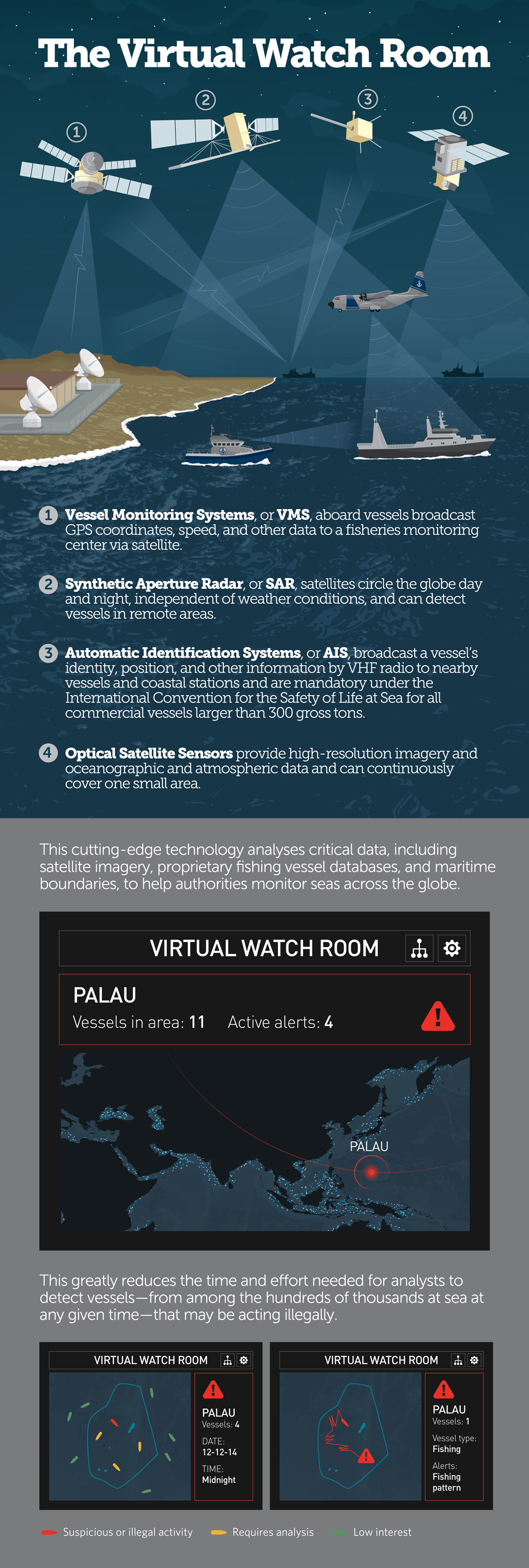
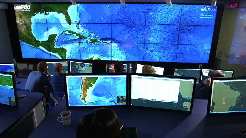
To help meet this challenge, The Pew Charitable Trusts has partnered with Satellite Applications Catapult, a U.K. government initiative created to help foster economic growth through the exploitation of space. Together, they have pioneered a system that enables government officials and other analysts to identify and monitor unlawful activities in global waters, particularly illegal, unreported, and unregulated fishing, sometimes referred to as pirate fishing. This cutting-edge technology merges satellite tracking and imagery data with other sources of information, such as fishing vessel databases and oceanographic data, to help monitor seas across the globe.
The partnership builds on work by the Catapult to develop a system that can synthesize and automate analysis of multiple data sources in near real time to identify vessels acting suspiciously. The system then can alert users so that they can investigate and take action. It is much more efficient than current processes and drastically reduces the human power required to detect and analyse suspicious activities.
Pew has made this work a priority to help answer the question of how governments can protect large-scale marine reserves. In response to growing needs, Pew has initiated a Virtual Watch Room—focused on marine reserves—that will be powered by the Catapult system.
The Virtual Watch Room for marine reserves is just one of the projects that Pew and the Catapult are working on to develop technological and policy approaches to stop illegal fishing in the world’s oceans.

Using the Virtual Watch Room to identify suspicious activities
- The application is designed to hold and cross-reference vast amounts of data so that when fused, the results can help identify suspicious vessel activity in an efficient and cost-effective way.
- The information includes multiple sources of satellite data, vessel and other specialist databases, international
fishing and marine reserve boundaries, and oceanic data such as depth and temperature.
- The system can activate the most appropriate surveillance method to see vessels that are not transmitting their positions.
- Automatic alerts are triggered when the computer, using specially designed algorithms, detects:
- Patterns of vessel movements or speeds typical of fishing.
- When a vessel has stopped signaling its position.
- Two vessels in close proximity, a possible sign of transshipment of fish or other goods.
- When a vessel crosses a virtual geofence to enter a marine reserve or other area of restricted use.
- Alerts are investigated by trained analysts.
- Analysts notify relevant government enforcement of highly suspicious activity and transfer a data package of supporting evidence.
- Governments proceed with enforcement action or other appropriate response.
As the system develops into the next phase, new data sources will be integrated to add emerging technologies and respond to evolving needs. Among the potential sources are additional satellite imagery, various types of optical imagery, imagery from unmanned aerial vehicles, crowd-sourced photographs and sightings, electronic signals such as radar on ships, and possibly radio broadcasts.


This video is hosted by YouTube. In order to view it, you must consent to the use of “Marketing Cookies” by updating your preferences in the Cookie Settings link below. View on YouTube
This video is hosted by YouTube. In order to view it, you must consent to the use of “Marketing Cookies” by updating your preferences in the Cookie Settings link below. View on YouTube


