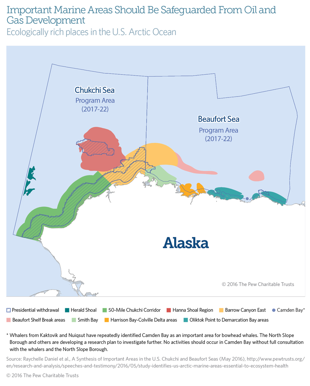
A Look at Important Marine Areas in the U.S. Beaufort and Chukchi Seas
Ecologically rich places to protect in the Arctic Ocean
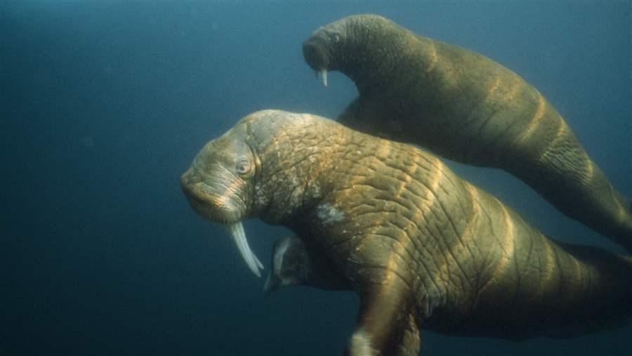
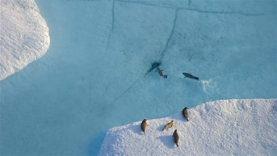 © Steven Kazlowski
Overview
Sound decision-making about the future of the U.S. Arctic Ocean must include an understanding of how its marine ecosystems function. Although all areas of the U.S. Chukchi and Beaufort seas contribute to ecological integrity, some are especially vital to the health of that ecosystem. An extensive review by The Pew Charitable Trusts and nonprofit partners of the best available Arctic science from government, university, and industry researchers has identified several such important marine areas.1
These stretches of ocean contribute disproportionately to the Arctic marine ecosystem’s productivity,2 biodiversity, function, structure, and resilience. Important marine areas include wildlife migration routes, foraging hot spots, subsistence areas, seafloor habitats, ice habitat, and places with high primary productivity.
In January 2015, President Barack Obama—using his authority under the Outer Continental Shelf Lands Act— designated portions of the Chukchi and Beaufort seas off-limits to future oil and gas leasing in order to protect areas of importance for their unique and sensitive environmental resources and for subsistence use by indigenous peoples.3 However, if the ultimate goal is balancing responsible economic development and preservation of ecosystem health, then other sections of these seas also warrant consideration for protection.
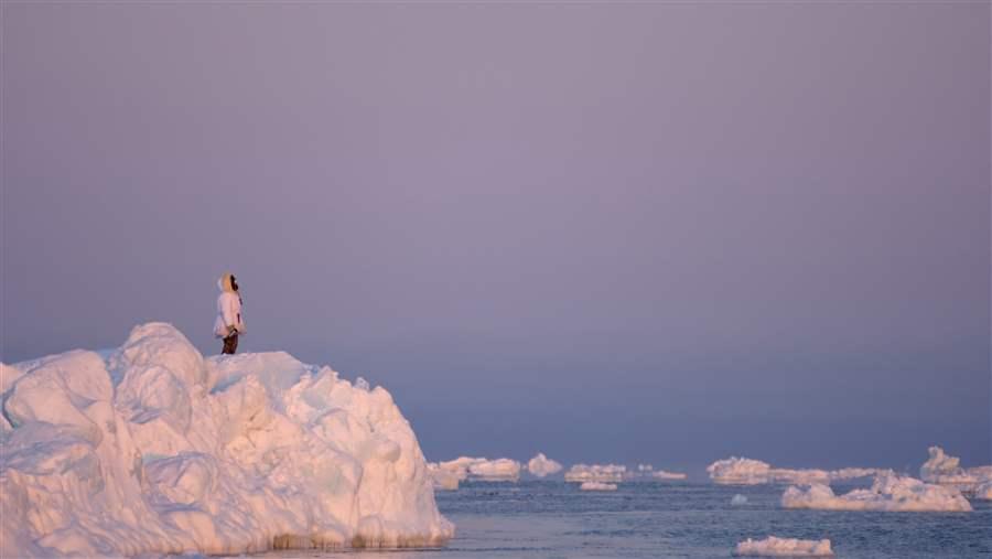
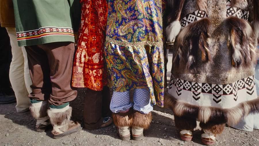 © Harald Sund
The ocean is integral to many Arctic indigenous communities’ way of life.
This brief identifies eight such marine areas: the 50-mile Chukchi Corridor, Hanna Shoal Region, Herald Shoal, Barrow Canyon East, Smith Bay, the Harrison Bay-Colville Delta areas, the Beaufort Shelf Break areas, and the Oliktok Point to Demarcation Bay areas. The map shows their locations, and the accompanying descriptions outline the remarkable resources as well as the features and geography that characterize them and make them likely to remain vital to the health of the U.S. Arctic, its wildlife, and its people for decades even as the climate changes.
In addition to their ecological significance, the Chukchi and Beaufort seas are important to the spiritual, cultural, and nutritional well-being of Iñupiat coastal communities. Any management decisions or regulations in the U.S. Arctic Ocean should be developed in consultation with local communities, governments, tribes, co-management bodies, and similar Alaska Native organizations.
Key areas of the U.S. Arctic are resilient and ecologically rich
The Arctic is rapidly changing. Temperatures in the region are warming twice as fast as those elsewhere on the planet,4 resulting in the rapid loss of summer sea ice. Nevertheless, places that are important today are likely to remain so, even if species shift or the food web changes.
Marine areas of greatest significance often have physical or oceanographic characteristics that underlie their importance, such as shore-fast ice zones, underwater canyons, and shallow shelves, which influence currents, upwelling, and other features that have an effect on productivity.5 Because of the durability of these coastal and seafloor features, areas that are productive today are likely to remain so in the future, even if the composition or magnitude of productivity changes. Any changes that may occur in these important marine areas are likely to be in the details of the food web such as a shift from benthic- to pelagic-dominated systems.6 Similarly, areas that are not productive now will probably not become so.
Protecting areas that are vital today and will remain so in the long term will have enduring benefits for the larger Arctic marine ecosystem.
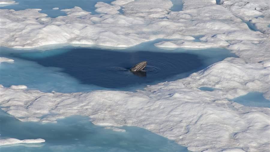 © Steven Kazlowski
A gray whale surfaces to breathe amid sea ice in the Chukchi Sea.
50-Mile Chukchi Corridor
Significant wildlife activity—including one of the largest marine migrations in the world—occurs throughout a 50-mile-wide band of ocean that traces the Chukchi Sea coast. This stretch is the thoroughfare for marine mammals and birds that migrate north from the Bering Strait to the Chukchi and Beaufort seas in spring and early summer. From winter through early summer the area is covered in sea ice, but a corridor of openings in the ice—called ice leads and polynyas—allows beluga and bowhead whales, walruses, ice seals, and seabirds to make their annual journeys.
Strong regional currents and seasonal sea ice dynamics provide consistent ice leads and polynyas year after year, so the area will continue to host extraordinary biological diversity and density even as the climate changes. The corridor has been permanently protected from offshore leasing from 3 to 25 miles offshore, but the waters from 25 to 50 miles out are also exceptionally valuable. In addition to hosting the spring whale migration, the outer band of the 50-Mile Chukchi Corridor has high seafloor productivity and serves as summer habitat for the eastern Chukchi stock of beluga whales; a feeding and reproduction area for gray whales in summer and fall; a staging (resting, drinking, eating) zone for king eider ducks; a migration route and staging and foraging area for spectacled eiders and other seabird species; spring sea ice habitat for bearded seals and the polar bears that hunt them; and foraging grounds for high concentrations of walruses in summer and late fall. The corridor also is used by resident ice seal species year round.
 © Bill Curtsinger/National Geographic
Pacific walruses, found in large numbers near Hanna Shoal, dive to the seafloor to feed.
Hanna Shoal Region
The shallows of Hanna Shoal divert warmer water from the Bering Sea so that cooler water remains and sea ice persists later into the summer. Regional currents and sea ice dynamics also contribute to high benthic biomass.7
The 1 million acres outlined by the 40-meter isobath surrounding Hanna Shoal were removed in 2015 from consideration for future oil and gas leasing. The larger Hanna Shoal region supports high primary production and remarkable benthic richness, making it a significant hot spot for walruses to forage in the Chukchi Sea. The abundance of benthic species feeds ice seals and gray whales. This important ocean corridor links the Hanna Shoal area to the Chukchi coast and protects walruses as they swim between their fall haul-outs on shore and feeding areas near the shoal. Bowhead whales also forage throughout the Hanna Shoal region each fall.
Herald Shoal
Like Hanna Shoal, Herald Shoal is a shallow rise that provides rich foraging habitat and high levels of benthic biomass and sustains above-average biodiversity compared with the rest of the Chukchi Sea. Herald Shoal is likely to continue to be a place where sea ice remains longer into the summer than in surrounding areas, making it valuable well into the future.
 © Steven Kazlowski
A subsistence hunter observes the seascape at Point Barrow near Barrow Canyon.
Barrow Canyon East
Barrow Canyon is a deep, 150-mile-long submarine canyon straddling the Chukchi and Beaufort seas. Here, ocean mixing and upwelling and sea ice movement yield high primary production, zooplankton, and benthic biomass, attractive food sources for migrating species. Future oil and gas leasing will not be permitted in designated waters surrounding the canyon: the Beaufort Sea Barrow Whaling Area west of Point Barrow and a subsistence area north of Barrow in the Chukchi Sea. But the ecologically valuable habitat east and northeast of Barrow Canyon is still available for future leasing.
Fall wind and current conditions in Barrow Canyon East drive the upwelling of zooplankton and entrapment of krill. Bowhead whales come to the area to feed on these tiny organisms (copepods and euphausiids in particular) while beluga whales feed on Arctic cod around the canyon and along the shelf break to the east. In spring, both whale species’ migrations pass through these waters, following the breakup of sea ice.
Beaufort Shelf Break areas
The Beaufort Shelf Break provides important habitat for the beluga whale migration to the Canadian Beaufort Sea. Although at times the entire shelf break provides a pathway for these mammals, some segments of the shelf are used by half the migrating population. One section of the shelf that extends 100 miles from the eastern edge of Barrow Canyon into the Beaufort Sea hosts high concentrations of beluga whales during spring and fall migrations and bowhead whales in spring. Farther to the east lies a segment north of Kaktovik, Alaska, that is broader than the rest of the slope in the U.S. Beaufort Sea. It is a hot spot for beluga whales in summer and a high-use area for male beluga whales from the eastern Chukchi and Beaufort seas stocks every fall. The spring migration corridor for bowhead whales also overlaps with this segment of the slope.
 © Steven Kazlowski
Beluga whales use the shelf break along the Beaufort Sea as a feeding area and major migration corridor.
Smith Bay
Smith Bay, which stretches from Dease Inlet to Cape Halkett, supports a remarkable range of Arctic and migratory species. The shallow, estuarine waters host high concentrations of euphausiids and other zooplankton, on which bowhead whales feed in summer and fall. Smith Bay also attracts shorebirds each fall and is a National Audubon Society Important Bird Area for globally significant numbers of king and spectacled eiders, yellow-billed and red-throated loons, and Pacific black brant. Spotted seals haul out along the coast and islands between July and November, and ringed seals build snow-covered lairs on the sea ice in winter and spring.
Harrison Bay-Colville Delta areas
Just east of Teshekpuk Lake, the Colville River flows into Harrison Bay. Because of the powerful river outflow, Harrison Bay is shallow, rich with nutrients, and more productive than most of the U.S. Beaufort Sea’s nearshore areas.
The waters of Harrison Bay and the Colville delta make an ideal refuge and globally significant bird area for longtailed ducks, king eiders, red-throated loons, Arctic terns, surf scoters, brant, and glaucous gulls. In summer and fall, migrating red-throated and yellow-billed loons and king and spectacled eiders stop in to rest and feed.
In addition to the many birds, wintering polar bears hunt and feed on ice seals in the shore-fast ice, along open leads, or at openings in pack ice. Pregnant polar bears frequently build winter dens in and around the area.
In recognition of its vital role in the lifecycles of these species, the Alaska Department of Fish and Game has designated the Colville River Delta a most environmentally significant area (MESA).
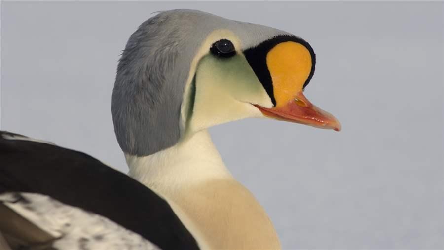 © Steven Kazlowski
The king eider’s colorful profile is a familiar sight along the Beaufort Sea coast.
Oliktok Point to Demarcation Bay areas
The nearshore areas of the central and eastern Beaufort coast are an important migratory thoroughfare for fish and marine mammals. The region’s lagoons, barrier islands, and surrounding waters provide ideal conditions and food for many species. For example, surveys around Cross Island—which is used by subsistence hunters as a staging location for the fall harvest—have consistently found higher concentrations of bowhead whales than in surrounding areas.
Bowheads rest and feed on zooplankton in these waters in summer and at the start of their long fall migration to the Bering Sea. Bearded and ringed seals forage on this portion of the continental shelf each summer and fall. Shore-fast ice serves as pupping habitat for ringed seals, attracting high densities of polar bears looking for food and places to build maternal dens.
A significant proportion of the world’s long-tailed ducks, king eiders, red-throated loons, Arctic terns, surf scoters, brant, and glaucous gulls can be found in the Oliktok Point to Demarcation Bay areas during the summer and fall. And each fall, black guillemots and Kittlitz’s murrelets also flock here to feed on benthic organisms.
These places serve as important subsistence areas for residents of the nearby Iñupiat villages of Nuiqsut and Kaktovik and encompass two unique habitat areas designated by the Alaska Department of Fish and Game as MESAs: Howe/Duck Islands and Sagavanirktok River Delta, Stefansson Sound Boulder Patch.
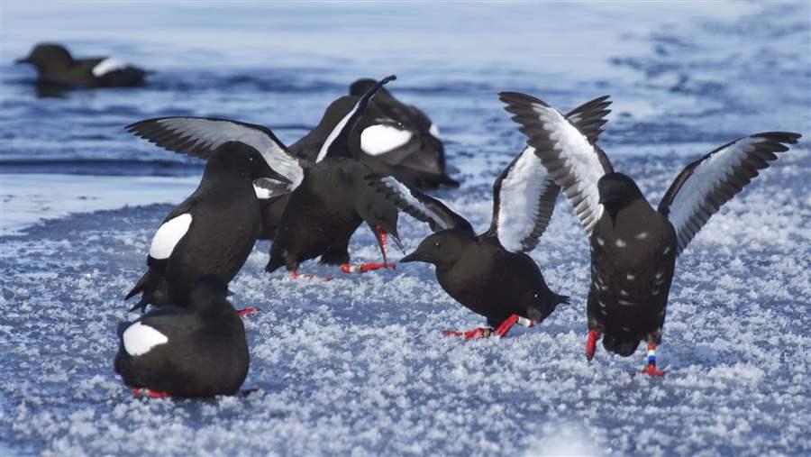 © Kathleen Stafford
Black guillemots on Arctic sea ice.
Conclusion
The balance between development and conservation in the U.S. Arctic Ocean demands ongoing evaluation, in consultation with indigenous communities and scientists, to identify important areas where certain kinds of industrial activity should be prohibited in order to ensure a healthy, sustainable, and resilient ecosystem for the long term.
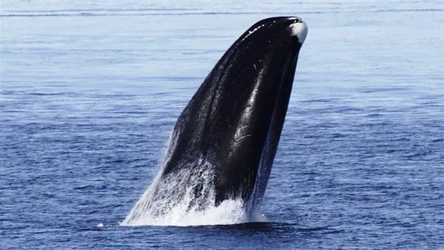 © Kate Stafford
A bowhead whale emerges from Arctic waters along the northern Alaska coastline.
Endnotes
- Raychelle Daniel et al., A Synthesis of Important Areas in the U.S. Chukchi and Beaufort Seas (May 2016), http://www.pewtrusts.org/en/research-and-analysis/speeches-and-testimony/2016/05/study-identifies-us-arctic-marine-areas-essential-to-ecosystem-health. This synthesis was conducted by Oceana, Ocean Conservancy, WWF, Audubon Alaska, and The Pew Charitable Trusts.
- Primary productivity refers to photosynthesis and other processes by which microscopic organisms convert inorganic materials into organic matter, which powers the marine food web.
- The White House, “Presidential Memorandum: Withdrawal of Certain Areas of the United States Outer Continental Shelf Offshore Alaska From Leasing Disposition” (Jan. 27, 2015), https://www.whitehouse.gov/the-press-office/2015/01/27/presidential-memorandum-withdrawal-certain-areas-united-states-outer-con.
- National Oceanic and Atmospheric Administration, “Arctic Report Card: Update for 2015,” last updated Nov. 17, 2015, http://www.arctic.noaa.gov/reportcard/air_temperature.html.
- Shore-fast ice zones are areas where sea ice forms in shallow waters and attaches to the shoreline, forming a platform of ice extending from the land.
- The term benthic refers to the bottom and associated sediments in a body of water. In marine ecosystems such as the U.S. Arctic Ocean, this means the seafloor and the organisms that live on it. The term pelagic refers to the upper waters of the ocean.
- Benthic biomass refers to the total mass of living organisms on the seafloor.


ADDITIONAL RESOURCES


