U.S. Coast Guard Proposes New Shipping Route and Safety Measures for Bering Strait
Action aims to mitigate risks of increased vessel traffic to marine mammals and coastal communities
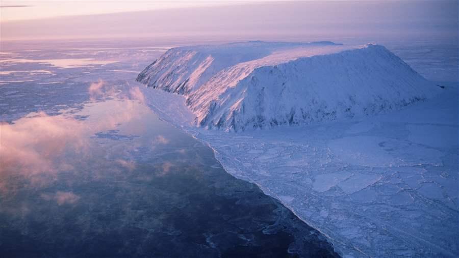
Vessel traffic through the Bering Strait, seen here with Little Diomede on the U.S. side, is increasing. The strait is just 44 nautical miles across and is a chokepoint for migrating marine species and ship traffic.
© Getty Images
Vessel traffic through the Bering Strait and northern Bering Sea could become safer as a result of new recommendations from the U.S. Coast Guard. This week the Coast Guard released its Bering Strait Port Access Route Study after a 6-year public process to develop a route and additional safety measures for the gateway between the Pacific and Arctic oceans.
The study identifies a preferred route and four areas that vessels should avoid because they contain hazards—such as strong currents or shoals—or particularly environmentally sensitive marine habitat. The four areas to be avoided (ATBAs) include Nunivak Island, St. Lawrence Island, King Island, and Little Diomede Island.
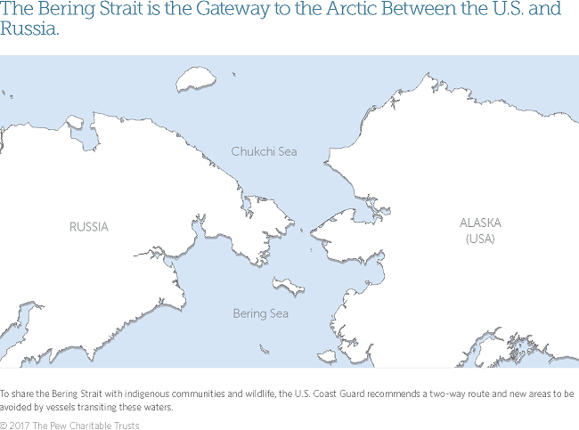
The Bering Sea and Bering Strait region is poorly charted, and weather conditions can rapidly turn from clear and calm to high seas, strong winds, and dense fog. These ATBAs are commonsense safety measures that will be important to keep vessels from veering too close to the islands and local communities when challenging weather forces them from the recommended route. Owing to the lack of oil spill response capacity in the study region, these areas will help reduce the likelihood of a ship wrecking and enhance the environmental protection of species important to the region that migrate through the strait, including whales, ice seals, walruses, and seabirds. Keeping large vessels on defined routes will also help to prevent collisions with small hunting boats operated by indigenous peoples, who may travel up to 100 miles from shore. Ships that pass through U.S. waters, but do not come from or go to a U.S. port, are considered “innocent passage” and don’t need to comply with U.S. rules. In order for all ships to be held accountable to these safety measures and protect U.S. waters, the International Maritime Organization, which regulates shipping in international waters, will now need to approve a final version of these recommendations after a 90-day public comment period.
Learn more about Bering Strait ship traffic here.
Based in Anchorage, Alaska, Eleanor Huffines leads Pew’s U.S. Arctic conservation work.
ADDITIONAL RESOURCES


