Rugged, Scenic Public Lands of Southwest Utah Merit Conservation
Community input critical to balanced management of renowned recreation areas
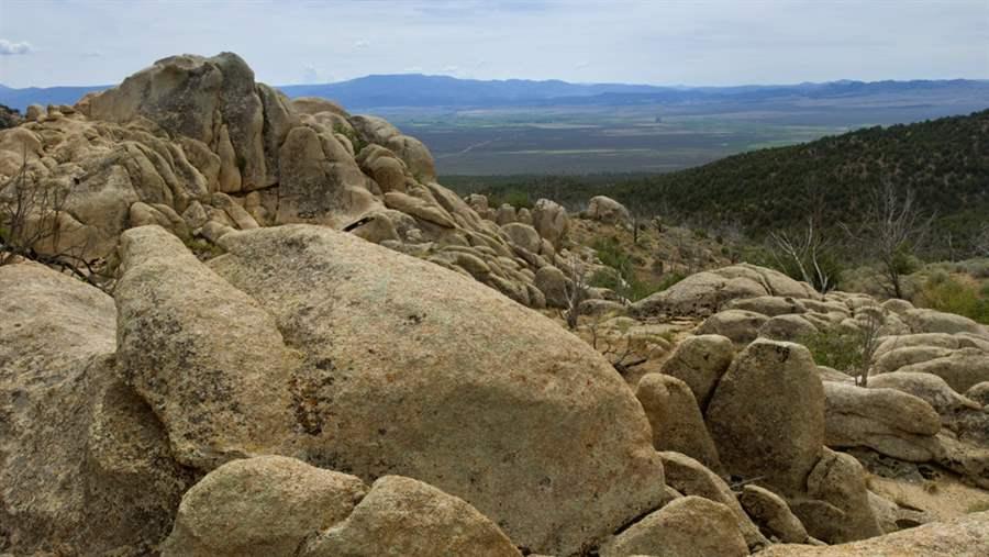
This area of Soldier’s Pass is managed by the BLM’s Cedar City Field Office in southwestern Utah
©
Southern Utah is known for big-name public lands, including Zion National Park, but few people outside the state are familiar with the remote area west of Cedar City, where mountain ranges and desert lowlands offer world-class hiking, wildlife viewing, mountain biking, backpacking and more—providing a big economic lift to the region.
The Bureau of Land Management’s (BLM) Cedar City Field Office oversees some 2.1 million acres of public land, including mountains that rise to over 9,000 feet, sagebrush and grassland, desert plains, cool aspen groves, critical wildlife habitat, and 2,500-year-old trees.
Economic value and spectacular beauty
These public lands generate significant revenue for communities in southern Utah. In a 2017 ECONorthwest report commissioned by The Pew Charitable Trusts, researchers found that visitors participating in “quiet recreation” such as hunting, camping, hiking, and mountain biking within the Cedar City Field Office planning area generate $12.3 million in total economic output annually, including $17.4 million in direct spending on those activities within 50 miles of recreation sites, and support more than 200 local jobs.
The BLM is updating its management plan for the area and, in light of the natural and recreational value of the lands, Pew is working with local partners to ensure that the final plan strikes a commonsense balance among conservation, recreation, and development.
Among the notable spots within the region:
- The Wah-Wah Mountains, about 240 miles southwest of Salt Lake City, are a spine of isolated peaks running from around 6,000 to 9,400 feet in elevation and providing refuge for a range of wildlife and plants. The Wah-Wahs are popular among outdoor enthusiasts seeking secluded, remote recreation. These mountains are also home to one of the longest-living organisms on Earth—the bristlecone pine tree—with some specimens here older than 2,500 years.
- The Needle Range, about 30 miles west of the Wah-Wahs, was named for its sharp and jagged peaks. The Sulphur Springs herd of Spanish horses roams this area, which also serves as an important mule deer and elk migration corridor. Pine Valley, in the eastern part of the range, is home to Utah prairie dogs and is a breeding, nesting, and brood-rearing habitat for greater sage-grouse, which also winter here.
- Modena Canyon, about 60 miles south of the Needle Range, contains some of the wildest land in southern Utah’s West Desert. The canyon is part of a “mega-linkage” of wildlife and plant corridors that extends from the Grand Canyon to central Idaho. Birders frequent the area to spot golden eagles, northern harriers, American kestrels, prairie falcons, and numerous hawk and owl species.
Pew encourages the BLM’s Cedar City Field Office to continue to work with all stakeholders to develop a final management plan that addresses multiple uses of these special public lands and ensures their conservation for current and future generations.
Ken Rait directs The Pew Charitable Trusts’ western lands initiative.
ADDITIONAL RESOURCES

Fact Sheet

Fact Sheet


