Central Nevada's Scenic Gem - Hiding in Plain Sight
The Pew Charitable Trusts is working with local organizations throughout the West and in Washington to ensure that planners at the Bureau of Land Management, or BLM, recognize the scientific, economic, and cultural imperatives to keep our West wild.
Profile
 For many people, Nevada is synonymous with Las Vegas, the name conjuring images of bustling nightlife, bright lights, roulette wheels, and maybe Wayne Newton. But in a big state with a lot of public land, there's much more to see by those ready to spend a little time traveling its back roads.
A good place to start is the Volcanic Hills-Emigrant Peak-Silver Peak area in Esmeralda County, about 200 miles northwest of Las Vegas. This region is among almost 47 million acres of vast Bureau of Land Management holdings in Nevada. The bureau's Battle Mountain planning district, which includes this area, comprises 13.5 million acres of federal, state, and private lands, as well as American Indian reservations in Esmeralda, Eureka, Lander, and Nye counties. The agency is preparing a Resource Management Plan that will determine how it oversees 10.5 million acres for the next 15 to 20 years. The Pew Charitable Trusts and local partners, such as Friends of Nevada Wilderness, are working closely with the agency to identify lands with wilderness characteristics and to encourage officials to make sure they are protected. These are generally areas without roads that have maintained their primitive character and are primarily undeveloped.
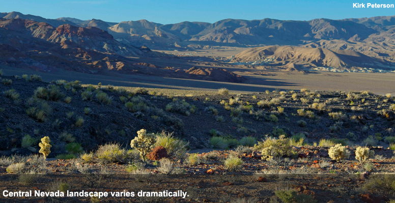
Kirk Peterson, inventory coordinator for Friends of Nevada Wilderness, said Volcanic Hills and Emigrant Peak “are stunning areas that are very photogenic, have bighorn sheep, and a bit of importance as sage-grouse habitat.” Peterson called the Gaps Springs marsh on the west side of the Emigrant Peak area “a green oasis in this beautiful, stark desert landscape.”
The terrain and vegetation vary dramatically across the region. They range from rolling terraces of desert shrub and low sagebrush at lower elevations over most of the Volcanic Hills, to steep rocky canyons and cliffs in the Silver Peaks, where the higher elevations are home to fairly dense stands of piñon-juniper.
“These areas exhibit a very rich quality of Nevada that is, in a lot of places, all but lost,'' said Julien Pellegrini, a member of the team that inventoried the region for Friends of Nevada Wilderness. “I can go on a hike for three or four days and know that I'm not going to hear the motor of a vehicle or four-wheelers.”
For years, the economy in southwestern Nevada has been largely dependent on mining, cycling between boom and bust. Peterson and Pellegrini are working to find a balanced approach to land management that adequately protects natural wonders such as the Volcanic Hills and Emigrant Peak areas.
Pellegrini said the solution can be found in safeguarding “the wealth of open spaces, the wealth of wilderness, and the wealth of solitude. This is a piece of Nevada's heritage that we need to protect for future generations.”
Learn more about the BLM's Battle Mountain planning process.
Video
Last summer, the public television series “This American Land” visited central Nevada to see what is so special about this part of the state far from the bright lights of Las Vegas. View the segment online or consult your local public television guide for details about the show in your area.
Travel Tips
Fill up with gas, carry plenty of water, and wear sunscreen and a hat. Cellphone service in this area is unreliable and a detailed printed map is a necessity. The BLM website offers inexpensive 1:100,000-scale surface management maps. For this trip, consult the maps for the Tonopah and Goldfield areas. Google Maps also covers the region.
Driving Directions
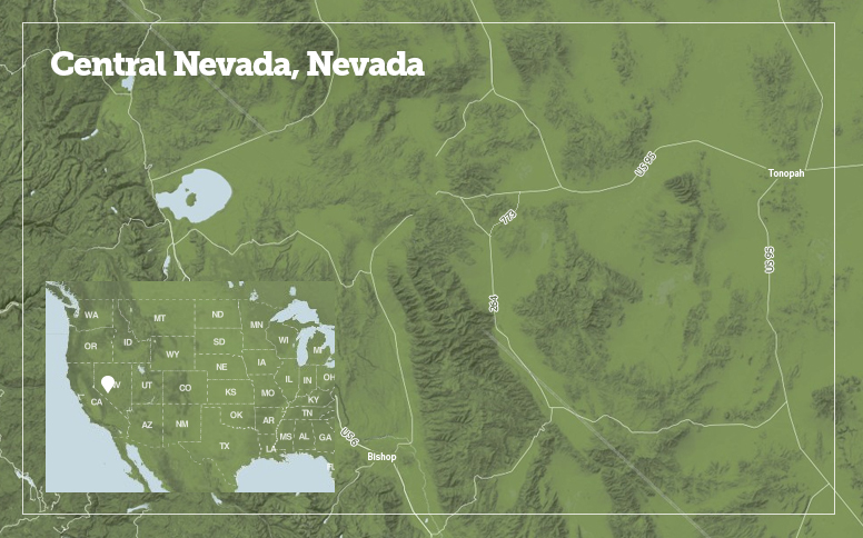
U.S. 6, once the nation's longest transcontinental road, is the only access to these regions, either from Bishop, CA, or from U.S. 95 at Tonopah, NV. To get to a great hike in the Volcanic Hills, drive from the junction of State Route 264 and State Route 773 northeast about a mile to the road that enters the wilderness on the left. Follow this to the end, then climb the mountain on foot. There are no trails, but the climb is fairly straightforward. The views from the summit are some of the most spectacular in the state. Look for the trail register on the highest summit and sign in. If you enjoy the visit, write a letter describing the wild values of this area to the Bureau of Land Management's Battle Mountain District Office manager.
Emigrant Peak is larger, with less access, but that is part of its wilderness charm. From U.S. 6, turn south on State Route 773 for about a quarter-mile, then continue south on Gap Springs Road (known as Emigrant Pass Road on Google Earth). The Gap Springs area would be a good place to start a hike into the west end of Emigrant Peak. Alternatively, traveling along Gap Springs Road until it merges with Emigrant Pass Road allows visitors to circumnavigate the west and south sides of the area. The lands to the east and north of these roads provide great opportunities for trail-less desert hiking and exploration.

