Congress Invests in Flood Preparedness
With funding for mapping and risk reduction, bipartisan bill will help Americans nationwide
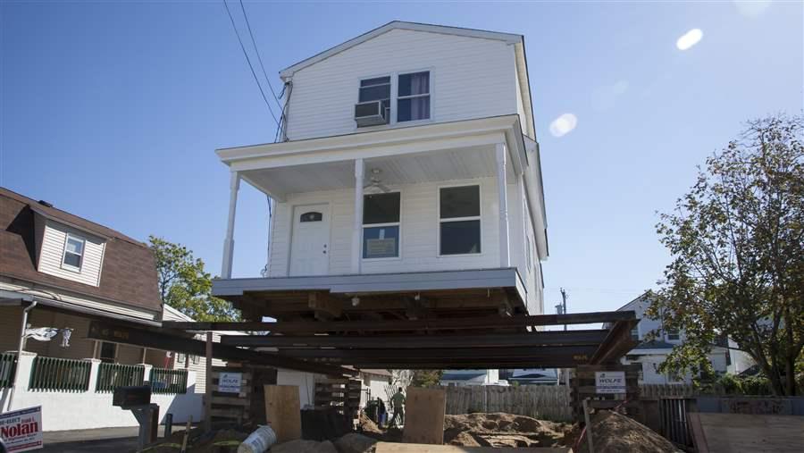
A house is raised off its foundation in the Highlands, New Jersey, which will result in reduced flood risk and lower flood insurance rates.
© iStock/Getty Images
Flooding is the most common and costly natural disaster in the U.S., a fact that is unlikely to change with the predicted increase in heavy downpours and other severe storms in many regions of the country. But the risk of floods could go down, thanks to Congress’ recent funding of two Federal Emergency Management Agency (FEMA) programs. The funding measures were included in the bipartisan budget bill, signed by President Donald Trump on May 5, that keeps the federal government running through September.
The bill, H.R. 244, allocates $100 million for FEMA’s National Pre-Disaster Mitigation Program and more than $345 million for the agency’s flood risk mapping efforts. These programs provide communities with critical flood hazard information and resources for state and local governments to plan for future natural disasters, thus reducing the impacts and costs from flooding, which has caused more than $260 billion in damages in the U.S. from 1980 to 2013.
Here’s a closer look at these programs.
The National Pre-Disaster Mitigation Program provides grants to state and local governments to retrofit facilities to better withstand floods, relocate hazard-prone buildings, and take other measures to reduce the overall risk to communities from flooding. The program is one of the primary federal resources available to help communities act prior to disasters.
However, demand for these grants far surpasses available funding. Historically, the annual average funding levels have exceeded $100 million but since 2010 have dropped by nearly half. With its recent funding approval, Congress will enable communities to make a down payment on preparedness. Economic analysis found that every $1 invested to reduce risk from disasters saves the nation an average of $4 in emergency response and recovery.

Flood risk mapping is the nation’s primary tool for identifying the most vulnerable areas, and it is required for communities to participate in the National Flood Insurance Program. Up-to-date and accurate maps provide information needed to minimize the risk of damages and loss of life.
However, the benefits of risk mapping go far beyond that by giving states and local officials the information they need to encourage smart development in areas least likely to flood. Also, flood risk maps are used by engineers, transportation planners, and others to identify areas in need of flood mitigation. These maps help emergency personnel respond to flooding and serve as a guide for recovery after storms.
Continued funding of both of these programs will help reduce Americans’ vulnerability to deadly floods and minimize the costs and effort of recovery when disasters strike.
Laura Lightbody leads The Pew Charitable Trusts’ initiative to help communities reduce the effects of weather-related catastrophes on the U.S. economy and environment through national policy reform.


America’s Overdose Crisis
Sign up for our five-email course explaining the overdose crisis in America, the state of treatment access, and ways to improve care
Sign up


After the Storm: Charleston’s Blueprint


The National Flood Insurance Program
Collected resources on reducing recovery costs and improving community preparedness
ADDITIONAL RESOURCES

Article

Article